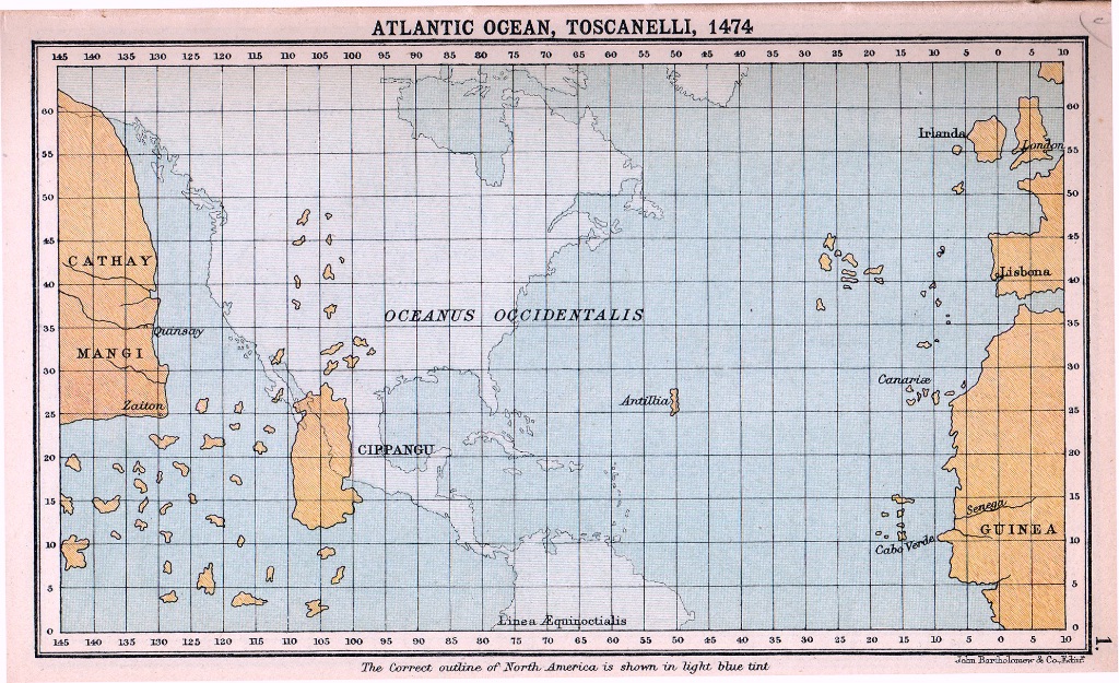
A depiction of Italian cartographer Toscanelli’s speculation that the Chinese (Cathay) mainland and Japan (Cippangu) were a straight shot across the Atlantic.
In light blue you see the real landmasses that the Europeans would soon learn about.
Columbus used this map as one of his sources for why sailing westward would allow a direct trade link to East Asia
#history
history #mapporn