
Thank you. For this I can have one good feeling about you. This isn't, btw, ABOUT you.
Political prisoner ROSS - IS FREE!!
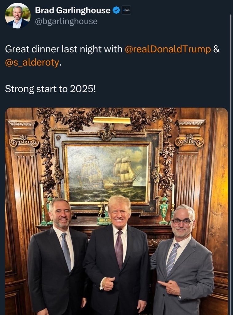
because ripple *IS* being set up to be the US DIGITAL CURRENCY!!
WARNING WARNING WILL ROBINSON!!!
Think about this:
Definition of **DOGE: the chief magistrate** in the former republics of Venice
ACCIDENT??
Learn even more!!😩
nostr:note1vne2xk3sjgc8wvghmrhl9hqjcuksgdzu62f9j2lpnlk3egtekkhqc43uj8

This is such a flash back... especially "no faster than 2400 baud". and remember the squeal!!
Thoughts are not "you"... but you do often *Identify* with them, confusing the sense of "I". As mentioned, it's more accurate that you are the observer.
(For less suffering: LOOK AWAY!)
No this is the TRENDING feed. Cuts off at poars that are just hours old. (My LATEST feed seems okay.)
WHY IS MY LOCAL FEED SO TRUNCATED??? HELP PLEASE @asknostr @primal
How very sweet. do you think it will help the mood out the globe? 😉
Almost reached 1000 subs on our #Bitcoin-only YouTube channel 👀
Link down below if you'd like to check it out 👇😁
https://www.youtube.com/@TheBitcoinWay

Go...go...go!
nostr:note1rca793vq5fvna5lmea579hrfpqhnnrr9huedc74nt5atdsxpah6qyn6rsr
@asknostr, @primal, ... Why is my Local feed ENDING apparently after n number of posts?? When refreshed, i lose access to some posts I'd just seen pre-refresh.
Is there something I can do to fix this?
Poke around, have fun, see who other ppl follow. Get lost, find your way back, repeat.
hmmmm...
nostr:note1dm0379wqha5aqz3uxdwrwlc5hzl04d0tkvuz7k2s7qznwfn9aupqtdkwpk
unsurprising. vacuous.
nostr:note1zy8t3htdsfhwqqjfu0f6n2mva65r6wngyxvx9h44nwmjl2z2nrasdhx6su
Absolutely! Marty needs to accept!
