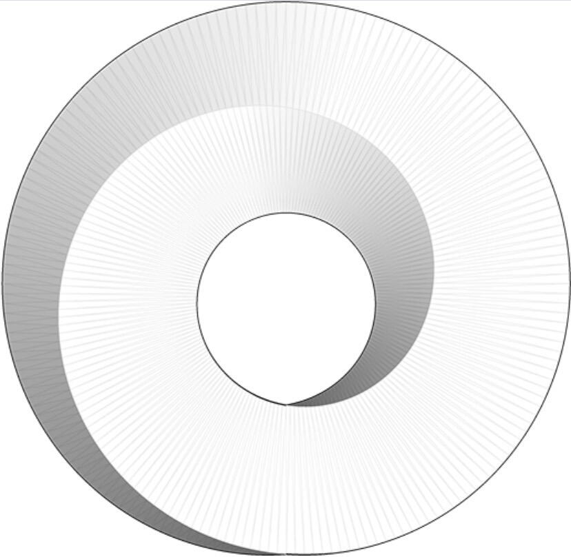
Based on a recent discovery, this is what the structure underneath the #pyramids of Giza looks like. As #NikolaTesla suggested, their purpose was likely to harness Earth’s energy. Mind-blowing 🤯
#Archeology
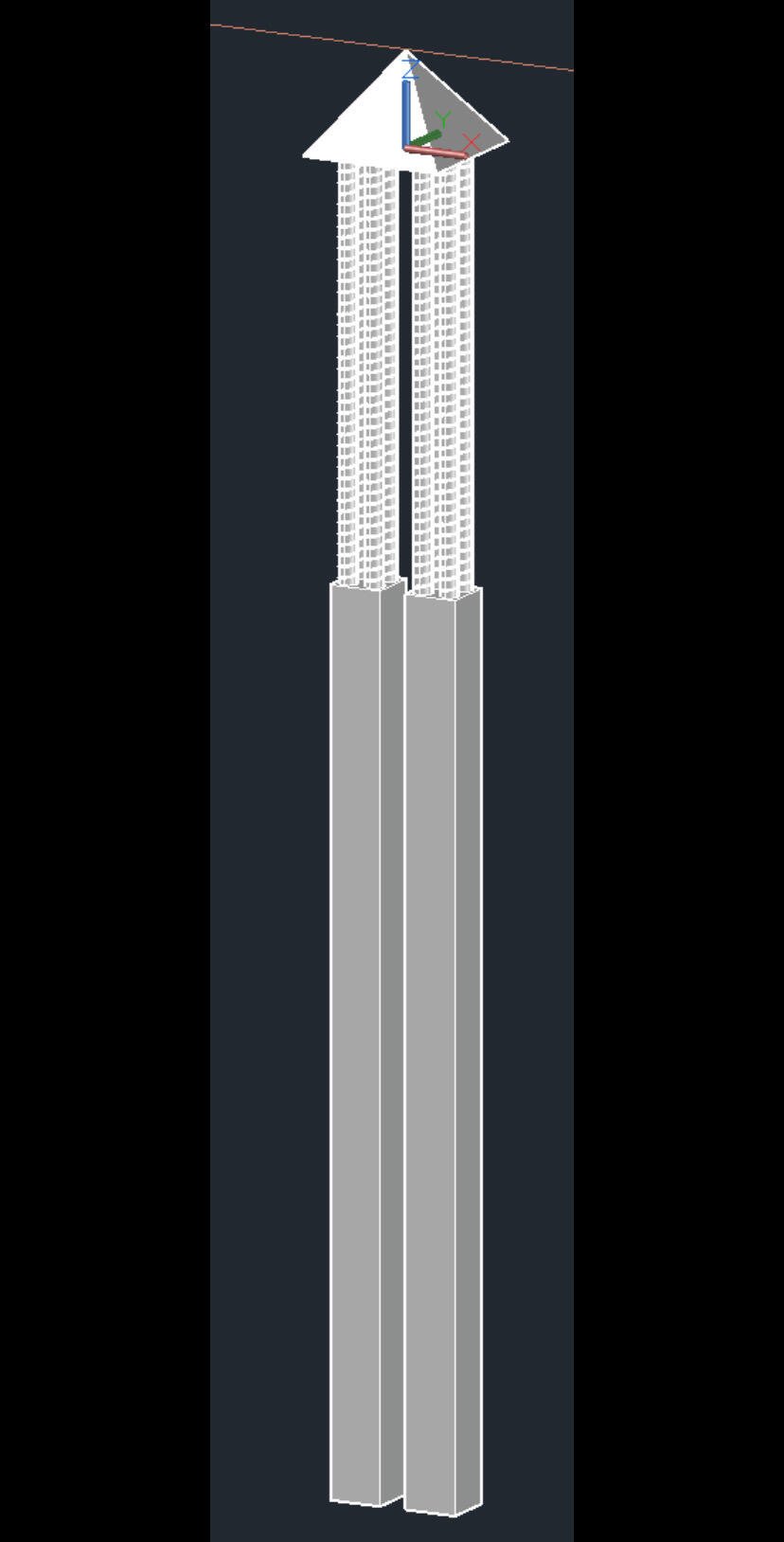
Based on a recent discovery, this is what the structure underneath the #pyramids of Giza looks like. As #NikolaTesla suggested, their purpose was likely to harness Earth’s energy. Mind-blowing 🤯
#Archeology
Where is the data? This seems pretty incredible.
I think only a press release has been published at this time by the researchers mentioning the underground structure. I haven’t read it yet so I’ll be looking for it to see if the statement is accurate. But here is the narrative that is being circulated online for more context:
nostr:note1a83pxgvkmtandawe5v9wkvvg7jljmep6uyxtwc6gsxd7kdvsqwdsd6sl62
According to this report, more information should be coming out in the next few days. So we still need more confirmation at this time.
"Biondi and Malanga had previously used synthetic aperture radar doppler tomography to identify an alleged internal structure in the Great Pyramid in 2022. The 2022 paper seems to be the only actual bit of published work related to the supposed claim. Malanga is an Italian UFO researcher who concluded “aliens” are actually interdimensional parasites that “hijack” human souls."
........... I'm afraid I'm going to have to see the data lol.
I don’t know these guys but the tone of this article is defamatory. On one hand, we should wait for more evidences to judge the credibility of the researchers’ claims, on the other, we shouldn’t discredit their work based on unsubstantiated defamatory comments.
somebody told me they read the actual paper that this latest news claims its based on. they said there is absolutely nothing of the sort in the paper... its all made up.
🤷♂️
Yeah I examined the paper and it's hard to see how they got these representations from the data readings. Will wait to see what else they publish.
Still, I don't believe these were tombs or built by the 'ancient Egyptians'.
This paper is from 2022 and doesn’t discuss the structure underneath but apparently the researchers claimed at a conference that more information discussing the structure underneath will be published soon. It’s still unclear if this is real or not but it has certainly gone viral.
blah blah blah #thegreatreplacement #whitegenocide #racerealism #jewishsupremacy
The original paper is, but they already released some early data on Saturday last week. Here is a video that covers it, the Land of Chem channel does a lot of analysis on the pyramids.
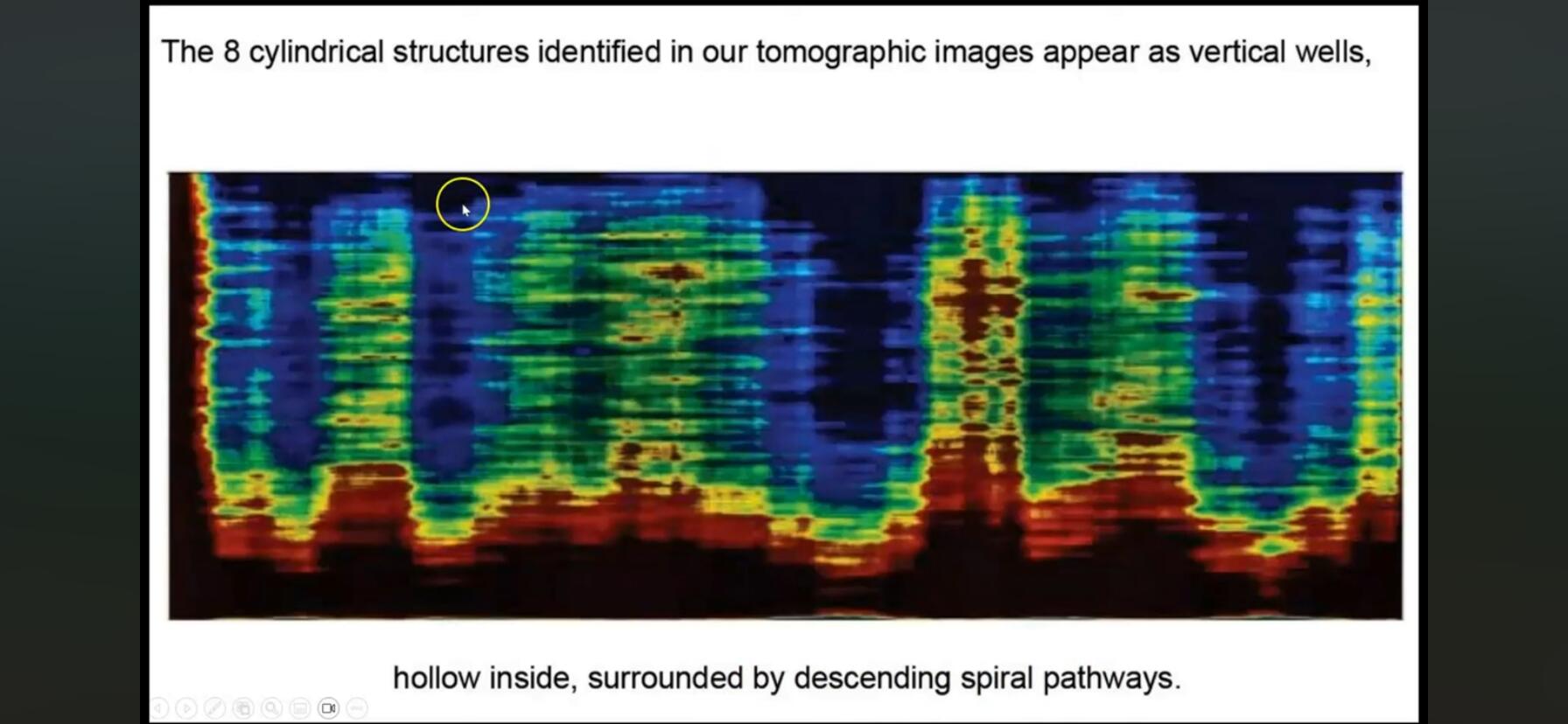
I scanned the video and I don’t find his debunking to be convincing. I can’t speak to the authenticity of the scans presented but they seem to show some cylindrical structures underneath the #pyramids. Anyway, it seems we should have more clarity once the full research is published.
I don't think he's trying to debunk it, just exhibiting skepticism. I shared this finding out to just as it broke earlier in the week, but before I had gone through some of the data.
I'm hoping they will have some good data to support it because I doubt most of what the dysgenic archeologists have the say about our history. Clowns like Nawas and Dibble are gatekeeping morons.
DeepSeek on the use of SAR to map underground structures:
Synthetic Aperture Radar (SAR) can partially map underground structures, but its effectiveness depends on environmental conditions and the material properties of both the surface and subsurface. Here's a breakdown:
How SAR Works for Subsurface Mapping
-Penetration Depth:
SAR uses microwave frequencies (e.g., L-band, P-band) that can penetrate dry, low-density materials like sand, ice, or arid soil. For example:
-Detecting buried ancient river channels in deserts.
-Mapping ice sheet bedrock beneath glaciers.
Limitations:
-Moisture/Clay: Wet soil or clay absorbs microwaves, blocking penetration.
-Resolution: SAR struggles with small or deeply buried structures (typically limited to a few meters in ideal conditions).
-Surface Clutter: Rough surfaces (e.g., vegetation) scatter signals, masking subsurface returns.
Comparison to Other Technologies
- Ground-Penetrating Radar (GPR): Better for shallow, high-resolution subsurface mapping (e.g., utility lines) but limited to small areas.
- LiDAR: Maps surface topography only.
Use Cases for SAR Underground
Mapping
- Archaeological surveys in deserts.
- Glacier/thick ice analysis.
- Large-scale geological fault detection.
In short, SAR can map certain underground features in specific conditions but is not universally reliable. For detailed subsurface imaging, GPR or seismic methods are more effective.