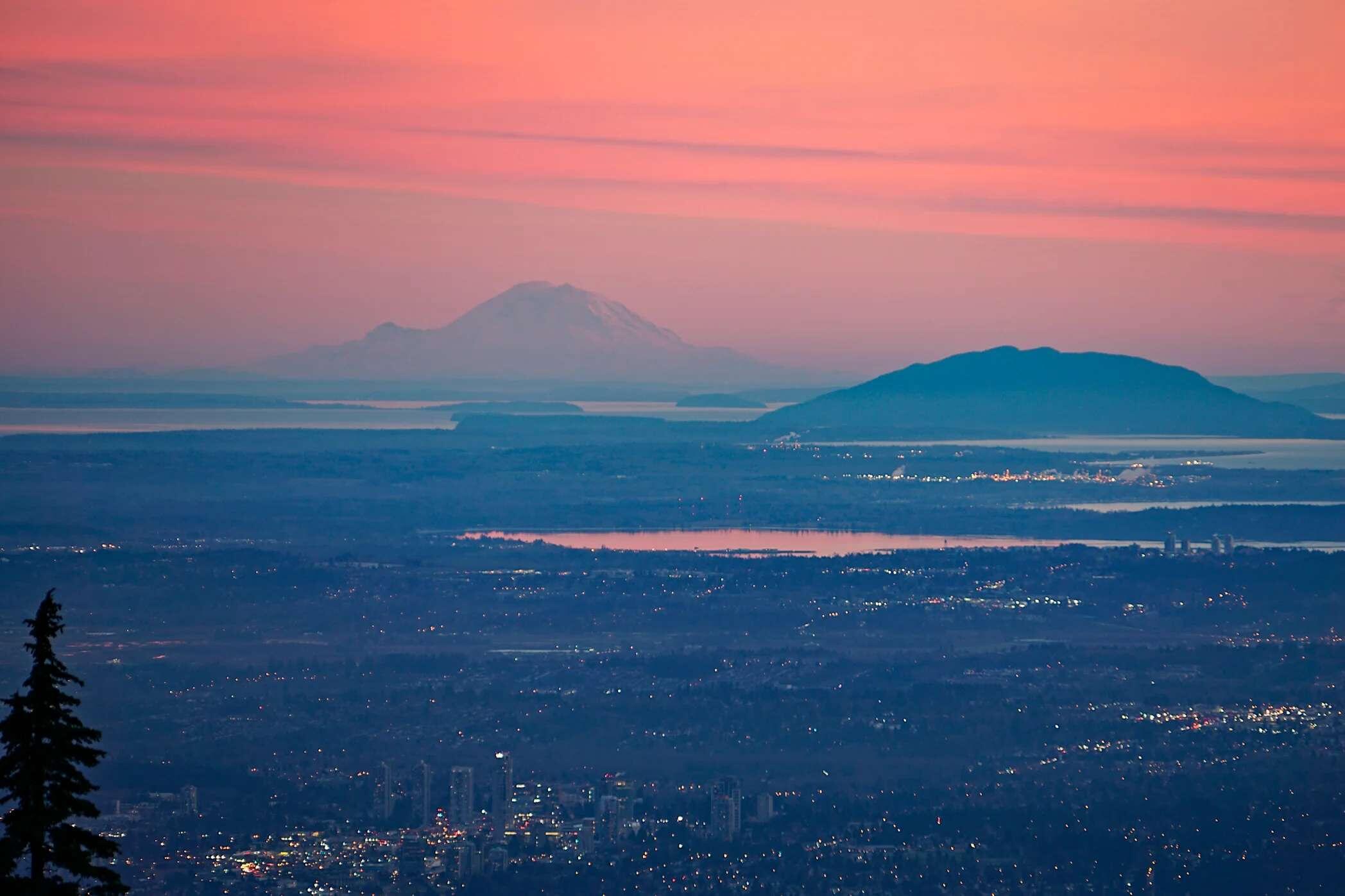
Lil quick test using some PNW landmarks I'm familiar with...

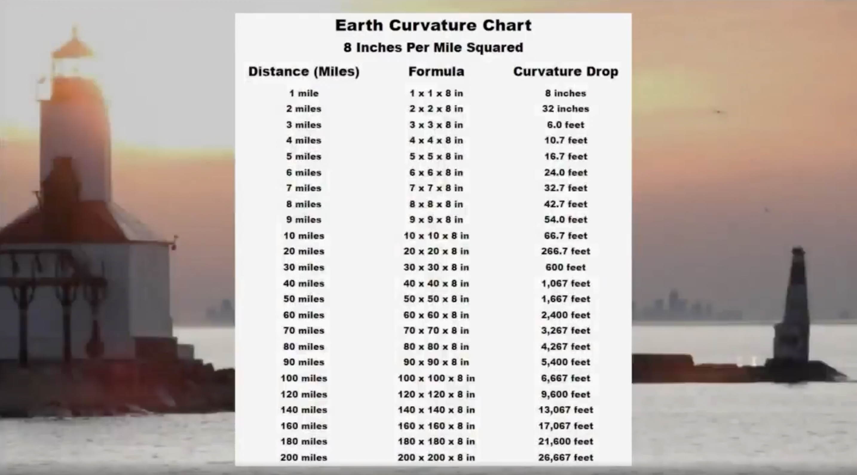
(See reference chart of how much drop in elevation we should see due to earth's curvature over certain ground distances.)

Here's a photo of Mt. Rainier from Vancouver B.C. Almost exactly 200 miles distance, which equal 5.05 miles of drop from curvature.

Tippy top of Mt. Rainier is 2.72 miles in height, so on net, from Vancouver B.C., that peak of the summit should be well hidden 2.33 MILES below ground level from the perspective of the photographer.

Yet you can see the BASE of the mountain, essentially bone-flat with Vancouver despite 200 miles of distance. That's mathematically impossible based on the globe model. #FlatEarth

nostr:nevent1qqsfj30ewvjj6k8ecc5tk2nkl9d33h5fqcwpxsj2cefwztkqk6feqpspz4mhxue69uhhyetvv9ujuerpd46hxtnfduhsygqqrzm7uvlmy5uyxcuuvt3f9lk8qznf4yas3m3hf3da49cunvu4vspsgqqqqqqsnzx3s4

Reply to this note

Please Login to reply.

Discussion

Looks like you took the pic from halfway up cypress tho.

big

🤩 Wow!

This is an interesting idea. It would be most useful to test on smooth open water. It seems that on a perfectly smooth globe one in theory would not be able to see the top of the object extending up above the smooth surface on a globe. I don't know how the equation works when the perspective is from a highly elevated location. This perspective is well above sea level.

Both locations are not at sea level.

Atmospheric Refraction give an extra 10%

Refraction is a thing. A temperature dependent thing.

What you should really ask yourself is why can’t you always see the same amount of the mountain at all time when visibility isn’t limited?