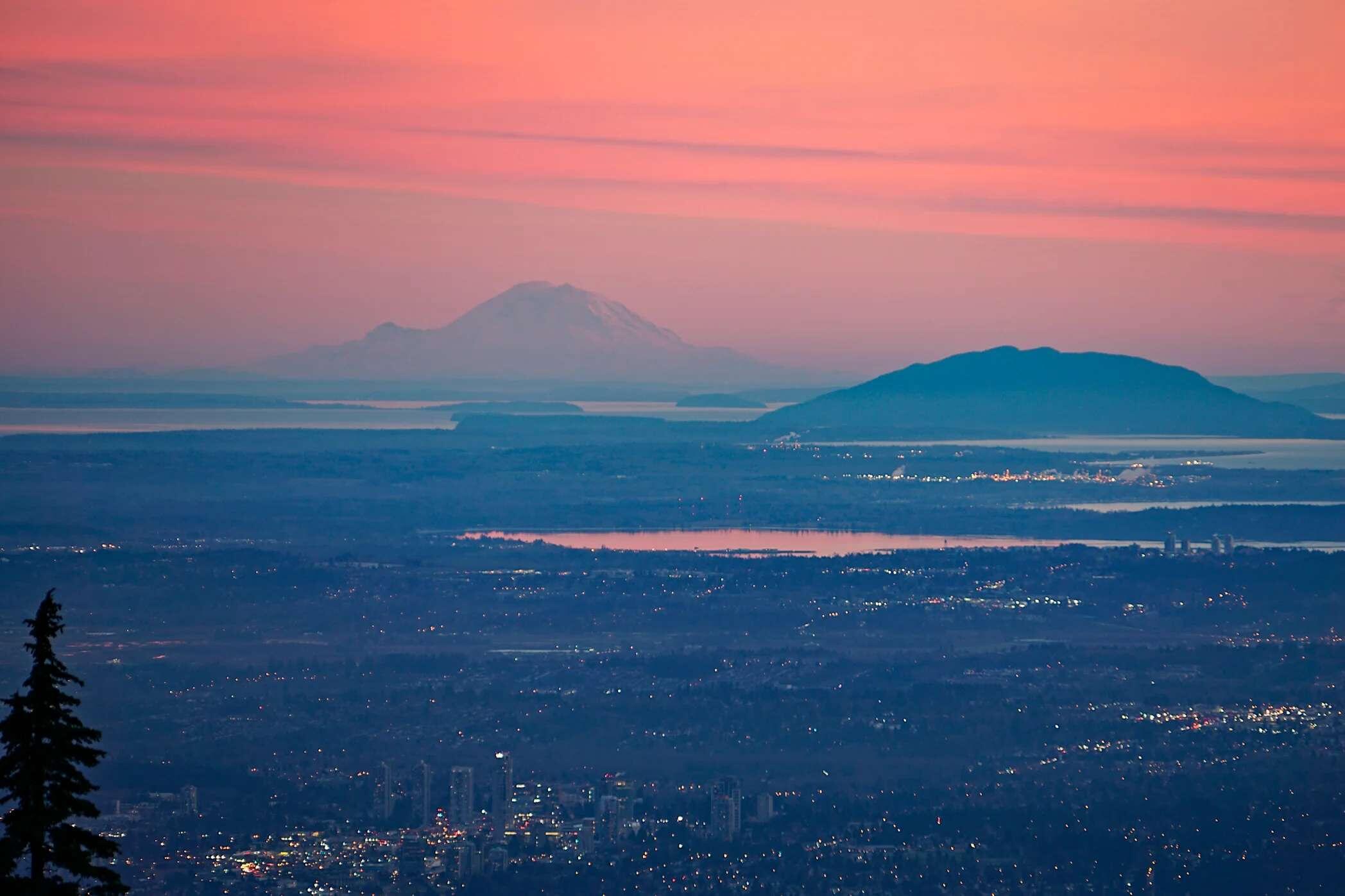
If you live somewhere where you can see a city, landmass, or landmark VERY far away (10 miles plus, ideally), then you can easily test the heliocentric globe model for yourself. (Binoculars/telescope are encouraged if you have them, so you can see even further; all that matters is that you can establish a visual.)

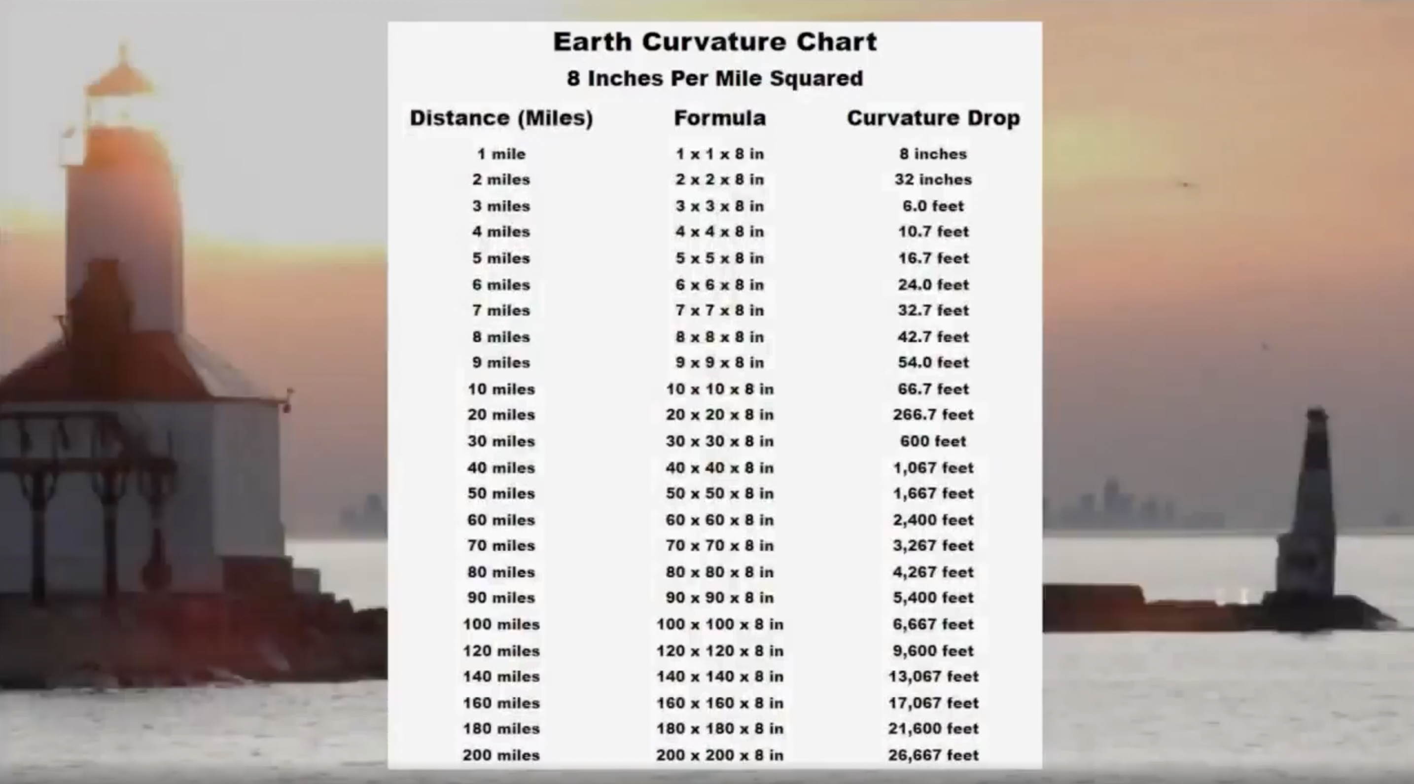
Once you've made eye contact with Location B from Location A (your location), refer to this chart for the corresponding distance of drop there should be from the curvature of the Earth, according to the official globe measurements.

Do you see the amount of drop that you should?

Report back with your findings!

Reply to this note

Please Login to reply.

Discussion

I can easily see the mountains in Banff AB. from Cluny AB. which is 150 miles away.

Huh...that's odd.

Because 150 miles of ground distance = 2.85 miles of drop due to earth's supposed curvature

Weird 🙃

Just playing around with numbers for fun, but you're probably seeing the peaks around Kananaskis and South of it? (Straight shot it's it's ~150 km away, Banff is like 194 km). Pretty sure Goat Mt beside Yamnushka isn't visible even at 2300 m, but Mt. Townsend should sorta be at 2780m. Lots of mountains south of that would be visible.

I took a look for fun at heywhatsthat.com (site for radio comms and earth curviture) and the red peaks on the attached map screenshot are the ones that should be able to see line of sight from where you live.

Figured nostr:nprofile1qqsqqx9hacelkffcgd3ecchzjtlvwq9xn2fmprhrwnzmm2t3exee2eqpzemhxue69uhkzarvv9ejumn0wd68ytnvv9hxgqg4waehxw309ajkgetw9ehx7um5wghxcctwvsq3wamnwvaz7tmxd9k8getj9ehx7um5wgh8w6twv5r638xm could have some fun with it.

It's a cool site to play with. You make a panorama from a point you want (your town) and then click on the map to see what's line-of-sight for radio comms. You can even turn on the earth curviture in the profile to see how it would look as a side shot.

Mountains from 250+ KMs

Lil quick test using some PNW landmarks I'm familiar with...

(See reference chart of how much drop in elevation we should see due to earth's curvature over certain ground distances.)

Here's a photo of Mt. Rainier from Vancouver B.C. Almost exactly 200 miles distance, which equal 5.05 miles of drop from curvature.

Tippy top of Mt. Rainier is 2.72 miles in height, so on net, from Vancouver B.C., that peak of the summit should be well hidden 2.33 MILES below ground level from the perspective of the photographer.

Yet you can see the BASE of the mountain, essentially bone-flat with Vancouver despite 200 miles of distance. That's mathematically impossible based on the globe model. #FlatEarth

nostr:nevent1qqsfj30ewvjj6k8ecc5tk2nkl9d33h5fqcwpxsj2cefwztkqk6feqpspz4mhxue69uhhyetvv9ujuerpd46hxtnfduhsygqqrzm7uvlmy5uyxcuuvt3f9lk8qznf4yas3m3hf3da49cunvu4vspsgqqqqqqsnzx3s4

The drop calculations must be wrong