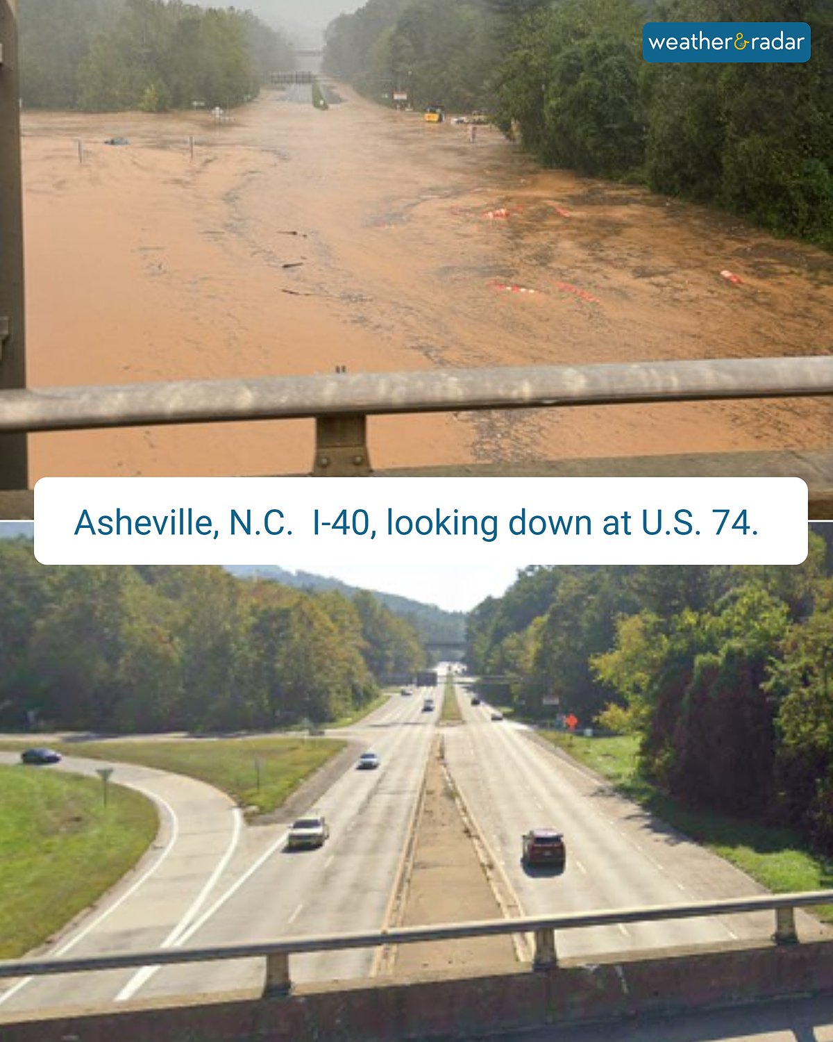
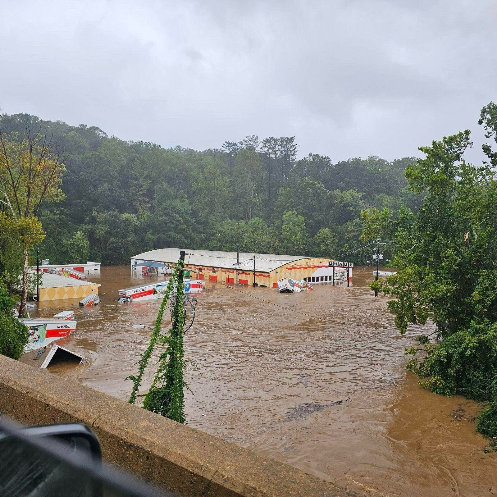
My brother just updated with a Facebook post of someone who found a path into/out of Asheville, NC!
For those in the area or trying to make their way in or out save this info and share it with friends!
"!! UPDATE ON FINDING A ROUTE HOME:
*if you are in Asheville, trying to get out (and have service to see
this post) listen up*
We finally found a route home!
We started on 240 West
Made our way down to 19 and 23 West
Took the Upward road to Hendersonville (exit 53)
Then turned left onto Spartanburg Highway
Turned left on 25 North to 26
Exit 8 onto 26
Exit 67 to Columbus
(Hendersonville, East Flat Rock, Columbus)
*there are places to get gas in Hendersonville but that's the
closest to Asheville we saw*
THIS IS NOT A QUICK ROUTE. ITLL TAKE YOU A FEW HOURS
BUT IT WORKS.
After that you should be in the clear!"
nostr:note1sgkm9zhplgn0808yszsdhgu9y6lkqygcwspqs30qalclwyr93shsfuly3n
Does anyone know how to draw out an extensive custom path on *any* major map service? Apple, Google, and Waze seem to have no option for this that makes any sense.
nostr:note1sgkm9zhplgn0808yszsdhgu9y6lkqygcwspqs30qalclwyr93shsfuly3n nostr:note1nku4c7tm54vd84m32f7mt7ugshsq84hdcpwy53ql92h5r5042asqsvjmdr
Thread collapsed